
Indigenous Culture Homelands
Years F–6
Free Starter Lessons
Year Overview
Foundation Year – My Place, Our Place
Australian Curriculum Content Descriptions
Overview
Students learn what paths are and how oral stories and maps can be used as a way to show us where things are while gaining knowledge of how knowing the land and where to find things can serve as a means of survival. Students explore the different environments in which plants and animals live, and they learn that all living things have requirements for survival that need to be met by the places where they live.
Learning Objectives
In Lessons 1 to 17, students learn to:
- identify what a map is
- make a model of their classroom
- describe the location of places on a map
- identify their place on Earth using a globe
- describe the features of places
- describe how the features of a school are used
- document the flora and fauna that live in a place
- compare the features of two places
- identify different types of pollution in their environment
- describe how our school environment can be cared for
- acknowledge the First People of Australia and their connection to Land
- identify and describe the seasons
- describe the features of the school playground
- create a map that includes the features of the school playground
- identify and describe changes that may happen to the school playground
- describe how to care for the school playground
- present their school playground portfolio.
Assessment
- Knowledge and Understanding Test (Lesson 18)
- Assessment Task – Portfolio (Lessons 13–17)
Complete This Unit
Lesson 1: Introduction to Maps
Lesson 2: Making Models of Places
Lesson 3: Describing Location
Lesson 4: Our Place in the World
Lesson 5: Features of a Place
Lesson 6: Use of Features
Lesson 7: Use of Features
Lesson 8: Comparing Places
Lesson 9: Pollution
Lesson 10: Caring for Our School Environment
Lesson 11: Acknowledging Our First People
Lesson 12: The Seasons
Lesson 13: Portfolio Item: Our Playground
Lesson 14: Portfolio Item: Map of Our School Playground
Lesson 15: Portfolio Item: Changes to Our School Playground
Lesson 16: Portfolio Item: Caring for the Playground
Lesson 17: Portfolio Presentation
Year 1 – Knowing Our Land
Australian Curriculum Content Descriptions
Overview
Students compare Indigenous concepts of seasons from different places with other cultures including the European concepts of spring, summer, autumn and winter. They recognise the features of a place and investigate the activities that occur in a particular place in regard to how these are connected to the seasons and the physical environment. Students suggest ways in which places can be cared for.
Learning Objectives
In Lessons 1 to 18, students learn to:
- recognise that places have features
- recognise and describe how features of places change
- identify and describe the natural features of places
- locate and position natural features on a map
- identify and describe the managed features of places
- plan and position managed features on a map
- identify and describe the constructed features of places
- locate and position constructed features on a map
- describe the direction and location of places on a map
- identify and describe changes in features of places
- identify why places need to be cared for
- identify how places can be cared for
- identify and describe the features of a local place
- create a labelled map that includes the features of a local place
- identify and describe changes that may occur to a local place
- identify why and describe how to care for a local place
- present their local place portfolio.
Assessment
- Knowledge and Understanding Test (Lesson 18)
- Assessment Tasks for Portfolio (Lessons 13–17)
Complete This Unit
Lesson 1: Features of the Place
Lesson 2: Describing Features
Lesson 3: Natural Features
Lesson 4: Locating Nature
Lesson 5: Managed Features
Lesson 6: Planning Managed Features
Lesson 7: Constructed Features
Lesson 8: Locating Construction
Lesson 9: Describing Features
Lesson 10: Changes in Features
Lesson 11: The Importance of Place
Lesson 12: Take Care of Me
Lesson 13: Caring for Places
Lesson 14: Local Features
Lesson 15: Local Maps
Lesson 16: Local Changes
Lesson 17: Local Care
Lesson 18: Portfolio Presentation
Year 2 – Our Connections to Place
Australian Curriculum Content Descriptions
Overview
Students explore places across a range of scales within Australia and Australia’s location in the world. Students represent and describe the position of objects on maps and within their local area. They gather, organise and display data on the places people have visited in Australia and examine the factors influencing people’s access to places. They discuss connections people have with places, both locally and globally.
Learning Objectives
In Lessons 1 to 18, students learn to:
- identify features of familiar places
- use direction words to describe the location of local places
- infer reasons for the location of features within a local place
- describe and represent places at the regional and national scales
- describe and represent places at the world regional scale
- describe their connections to local places
- identify factors that influence people’s connections to places
- sort and record data in tables about connections to places farther away
- describe a place of significance
- identify why significant places should be preserved
- choose a familiar place to study
- pose questions about a familiar place
- record information from observations
- interpret observations to make conclusions and suggest actions
- design a poster to present their findings
- share their poster with classmates.
Assessment
- Knowledge and Understanding Test (Lesson 18)
- Assessment Tasks for Portfolio (Lessons 11–17)
Complete This Unit
Lesson 1: Features of Familiar Places
Lesson 2: Describing Local Sites
Lesson 3: Features of Local Sites
Lesson 4: Regional and National Scale
Lesson 5: Our Place on the Globe
Lesson 6: Describing Local Connections
Lesson 7: Influence on Connections
Lesson 8: Connections to Places Farther Away
Lesson 9: Significant Places
Lesson 10: Preserving Local Places
Lesson 11: A Familiar Place
Lesson 12: Inquiry Questions
Lesson 13: Observations
Lesson 14: Drawing Conclusions and Suggested Actions
Lesson 15: Present Findings 1
Lesson 16: Present Findings 2
Lesson 17: Sharing
Lesson 18: Content Test
Year 3 – Exploring Places Near and Far
Australian Curriculum Content Descriptions
Overview
Students describe the location of the states and territories of Australia, the location of Aboriginal and Torres Strait Islander Countries/Places and the neighbouring countries of Australia. They will describe the characteristics of different places at local scales, how people are interconnected with these places and identify the similarities and differences of these places in comparison to their own place. Students will develop an understanding that people have different connections to places. Students will pose geographical questions, locate, collect and record information from various sources to answer these questions, and they will use this information to create tables and graphs to represent the collected data. Students will find the location of various places using a legend, a title, north point, grid references and compass points. They will understand that individual actions can be used in response to a geographical challenge.
Learning Objectives
In Lessons 1 to 18, students learn to:
- identify natural and manmade features of local places
- locate and describe indigenous countries in their area
- identify and label the states, territories and capital cities of Australia on a map
- identify and label the major manmade and natural features of Australia on a map
- locate, label and colour Australia’s neighbouring countries on a map
- identify, locate and describe the four main climate zones on Earth and create a legend
- identify, locate and describe the five major climate zones in Australia and create a legend
- compare the weather in different climate zones in Australia
- investigate what life is like in different places in Australia
- compare what life is like in Australia’s neighbouring countries
- investigate how a community uses a local park
- create a poster to save a local place from being developed
- identify why significant places should be preserved
- create a map with grid references, a legend, a title and natural and manmade features
- research what life is like in one of Australia’s neighbouring countries
- draw and colour a picture that represents life in their chosen country.
Assessment
- Knowledge and Understanding Test (Lesson 18)
- Assessment Tasks for Portfolio (Lessons 15–17)
Complete This Unit
Lesson 1: Features of Local Places
Lesson 2: Indigenous Countries and Places
Lesson 3: States and Territories of Australia and Capital Cities
Lesson 4: Natural and Manmade Features of Australia
Lesson 5: Australia’s Neighbours
Lesson 6: Earth Climate Zones
Lesson 7: Australia’s Climate Zones
Lesson 8: Comparing Climates
Lesson 9: Investigating Places
Lesson 10: Comparing Life in Different Countries
Lesson 11: How Does a Community Use a Local Park?
Lesson 12: Saving Our Local Place
Lesson 13: Preserving Significant Local Places
Lesson 14: Mapping
Lesson 15: Country Study Assessment
Lesson 16: Country Study Assessment
Lesson 17: Country Study Picture Assessment
Lesson 18: Content Test
Year 4 – Our Land Before Australia
Australian Curriculum Content Descriptions
Overview
Students identify ancestors of Indigenous Australians as the first humans to colonise Australia. Students read some ancestral stories that tell of migration and compare these with scientific explanations. They learn the approximate period in history when this happened, and the evidence found in the present. Students investigate the ‘Out of Africa’ theory. They are introduced to evidence that modern humans reached South-East Asia 70,000 years ago and that they spread to Australia at least 50,000 years ago.
Learning Objectives
In Lessons 1 to 25, students learn to:
- identify the continents of the world
- identify the oceans of the world
- examine what the landmass of Australia looked like long ago, during the time the first humans arrived
- describe reasons why animals migrate
- describe reasons why people migrate
- identify evidence that supports the scientific theory that humans moved out of Africa approximately 50,000 years ago
- describe possible ways that people arrived in Australia approximately 50,000 years ago
- describe a cultural myth from the dreamtime story, ‘The Koala and the Rainbow’ from long ago
- describe the movement of people to Tasmania and the evidence of their culture and history
- identify rock engravings and rock art that provide us with information about the lives and history of Australia’s Indigenous people
- identify archaeological sites from around the world that suggest people migrated
- identify fossils from the past
- recognise ancestors of Indigenous people as being the first humans to arrive in Australia.
Assessment
- Knowledge and Understanding Test (Lesson 25)
- Assessment Tasks for Portfolio (Lessons 1, 3, 5, 7, 9, 13, 18, 21, 23, 24)
Complete This Unit
Lesson 1: Continents
Lesson 2: Inflatable Globe Game
Lesson 3: Oceans
Lesson 4: Activity Jigsaw
Lesson 5: Sahul
Lesson 6: Activity Continents
Lesson 7: Animal Migration
Lesson 8: Migration Board Game
Lesson 9: People Migration
Lesson 10: Lasca and Her Pups
Lesson 11: Migration Evidence
Lesson 12: Whale Migration Story 1
Lesson 13: Paths
Lesson 14: Whale Migration Story 2
Lesson 15: Traditional Stories Give Us Evidence About Our Past
Lesson 16: Melting Ice Sheets
Lesson 17: Movement of Australia
Lesson 18: Indigenous People Lived Where Australia’s Cities Now Stand
Lesson 19: Rock Art
Lesson 20: Our Place in the World
Lesson 21: Science Gives Us Evidence That People Moved in the Past
Lesson 22: Map Traditional Land That Is Important to Us
Lesson 23: Fossils Give Us Evidence of Time
Lesson 24: First Humans to Arrive in Australia
Lesson 25: Content Test
Year 5 – People and Our Changing Earth
Australian Curriculum Content Descriptions
Overview
Students locate the continents of Europe and North America and identify how people have changed a particular environment in a country within each of these continents.
Students explore how Australia’s first people altered the environment and sustained ways of living through methods of land and resource management. They evaluate the effects of change on environmental sustainability. They identify and explore how land features influence where people live, how people use spaces, and the impact natural disasters such as bush fires and floods have on the environment and communities.
Learning Objectives
In Lessons 1 to 17, students learn to:
- identify and describe the location and direction of places
- recognise and explain the characteristics of local places
- recognise and explain the characteristics of regional places and states
- identify and describe the interconnection between people and the human characteristics of places
- recognise the effects of interconnections on the human characteristics of places
- identify and describe interconnection between people and the environmental characteristics of places
- recognise the effects of interconnections on the environmental characteristics of places
- identify and describe the interconnections between components of environments
- recognise geographical challenges
- identify and describe different possible responses to a geographical challenge
- identify and describe the location of a country using compass directions and distance
- recognise and explain the characteristics of a country
- identify and describe the interconnections between people and the human characteristics of a country, and recognise their effects
- identify and describe the interconnections between people and the environmental characteristics of a country, and recognise their effects
- identify and describe the interconnections between components of an environment of a country
- recognise a geographical challenge in a country, then identify and describe different possible responses
- present the findings of their portfolio of a particular country.
Assessment
- Knowledge and Understanding Test (Lesson 18)
- Assessment Task – Portfolio (Lessons 11–17)
Complete This Unit
Lesson 1: Location and Direction
Lesson 2: Local Places
Lesson 3: Regions and States
Lesson 4: Human Connections
Lesson 5: Human Effects
Lesson 6: Environmental Connections
Lesson 7: Environmental Effects
Lesson 8: Environmental Components
Lesson 9: Geographical Challenges
Lesson 10: Responding to a Challenge
Lesson 11: Portfolio Item: Country Location
Lesson 12: Portfolio Item: Country Characteristics
Lesson 13: Portfolio Item: Country Connections to Humans
Lesson 14: Portfolio Item: Country Connections to Environments
Lesson 15: Portfolio Item: Country Environmental Components
Lesson 16: Portfolio Item: Country Challenges
Year 6 – Our Diverse and Connected World
Australian Curriculum Content Descriptions
Overview
Students develop an understanding of place, space, environment, interconnection and change. They explore the diverse environments, peoples and cultures within the Asia region and at a global level (space, place and environment) and expand their mental map of the world. Students examine Australia’s various connections with other countries and places throughout the world, how these are changing, and the effects of these interconnections (interconnections, change).
Learning Objectives
In Lessons 1 to 18, students learn to:
- identify characteristics that make places different from each other
- describe the location of places in absolute terms
- examine the environmental diversity of Australia and Asia
- examine the demographic diversity of Australia and Asia
- examine the economic diversity of Australia and Asia
- graph the social diversity of Australia and Asia
- identify factors that influence their personal connection with global places
- summarise Australia’s interconnections with other places in the world
- describe how Australia’s connections change places and affect people
- explore geographical challenges
- develop appropriate geographical questions to frame an inquiry
- locate, collect and organise useful data and information from secondary sources
- write a questionnaire to collect primary data
- represent primary data in a graph
- list the effects of possible responses to a geographical challenge
- make and justify a proposal of action to a geographical challenge
- present findings and ideas in digital form.
Assessment
- Knowledge and Understanding Test (Lesson 18)
- Assessment Tasks for Portfolio (Lessons 10–17)
Complete This Unit
Lesson 1: Defining Diversity
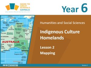
Lesson 2: Mapping Places
Lesson 3: Environmental Diversity
Lesson 4: Demographic Diversity
Lesson 5: Economic Diversity
Lesson 6: Social Diversity
Lesson 7: Our Connection to Places
Lesson 8: Australia’s Global Connections
Lesson 9: The Effect of Australia’s Connections
Lesson 10: Geographical Challenges
Lesson 11: Geographical Questions
Lesson 12: Secondary Sources
Lesson 13: Primary Sources
Lesson 14: Representing Data
Lesson 15: Proposed Actions
Lesson 16: Propose and Justify
Lesson 17: Presenting Findings
Lesson 18: Content Test
Other Units
Lesson Design
Lesson Objective
Success Criteria
Activating Prior Knowledge
I Do
We Do
Apple Question
You Do
Revise
Professional Learning
